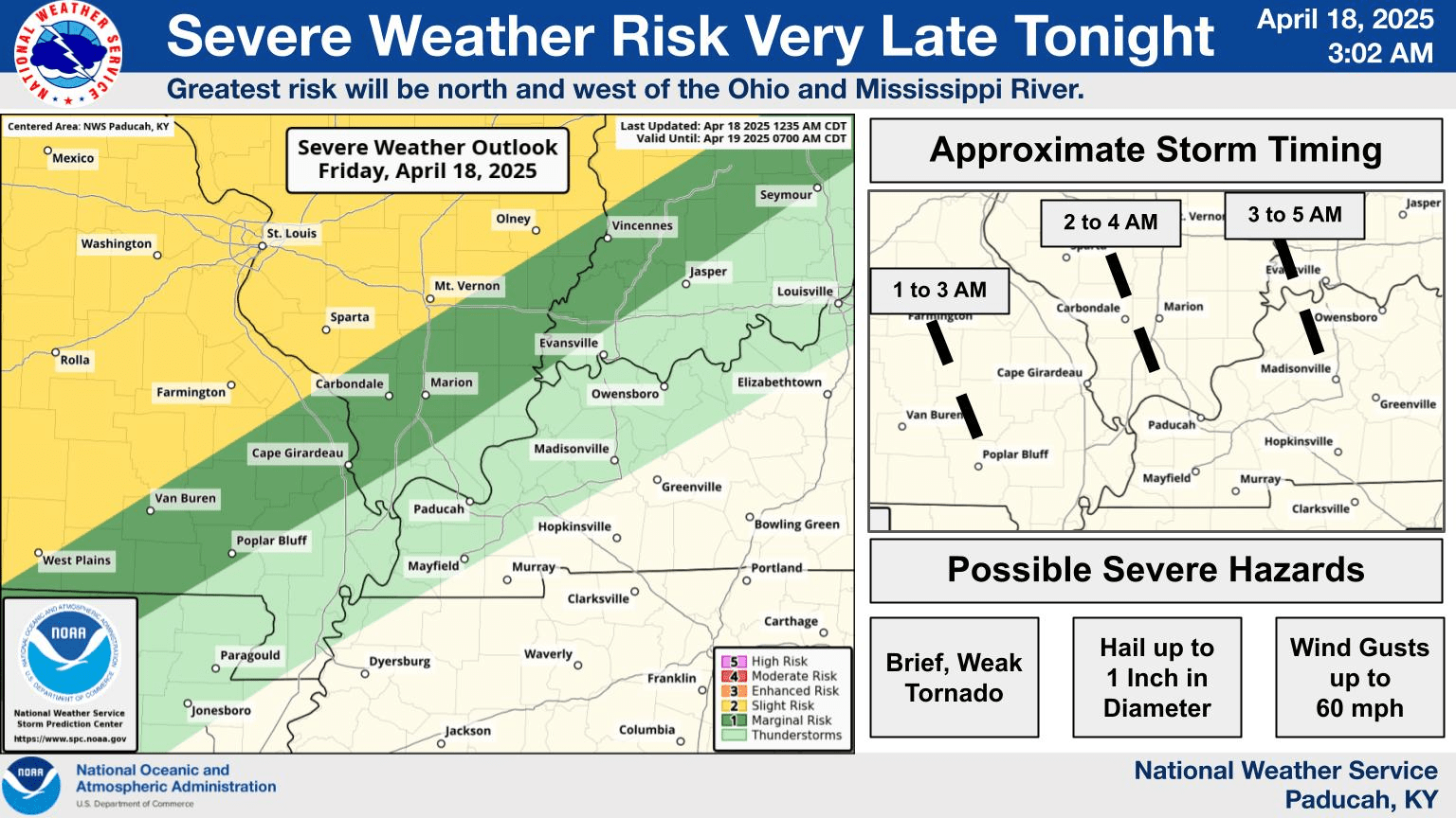
PADUCAH – It seems we are in store for a stormy Easter weekend.
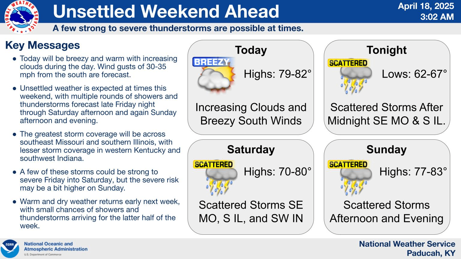
The National Weather Service in Paducah says thunderstorms will develop late tonight across southeast Missouri and southern Illinois and move into southwest Indiana. A few of these storms may become severe, with a brief tornado, large hail, and damaging wind gusts possible. The severe risk will be greatest between 1 and 5 Saturday morning.
Forecasters say showers and thunderstorms will happen again Sunday afternoon and evening. The greatest storm coverage will be across southeast Missouri and southern Illinois, with lesser storm coverage in western Kentucky and southwest Indiana.
Warm and dry weather returns early next week, with small chances of showers and thunderstorms arriving for the latter half of the week.